06 Dec University of Akron Program Puts Fleet Response on the Map

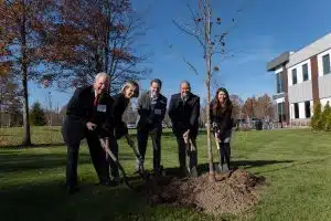
In November of 2021, during the ribbon cutting and grand opening ceremony of Fleet Response’s corporate headquarters, a ceremonial tree was planted as part of Holden Forest and Garden’s People for Trees Program.
To commemorate our relationship with Holden Forests & Gardens and the establishment of our new headquarters, Fleet Response has partnered with the University of Akron’s Surveying and Mapping Program.
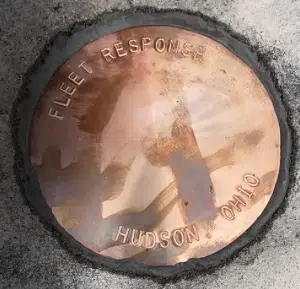
The idea originated from Landscape Designer, Tanya McInerney who then contacted Jeff Jalbrzikowski, Regional Advisor for the National Geodetic Survey (NGS) to help install a survey marker. Survey markers are used to determine distances between two points and were used to establish the first maps. They were also found along railroad corridors. “Since Fleet Response is centered around the transportation industry, the survey marker is a fun link”, said McInerney.

(CEO, Scott Mawaka and President, Allison Lanzilotta with Representatives from Holden Forests & Gardens)
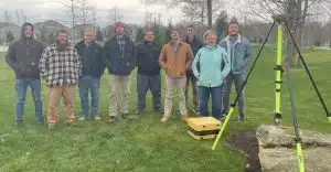
Jalbrzikowski, who is a University of Akron graduate, directed McInerney to Ann Besch and Joe Fenicle, professors at the University of Akron’s Surveying and Mapping Program. Besch and Fenicle decided that this would be a great group project to allow their students to collect survey data on the newly installed point for their senior capstone class.
Nine seniors from the University of Akron Surveying and Mapping Program (Aaron Sowick, Dalton Lopp, Eric Kingsley, Frank Powers, Mitch Wilburn, Thomas McMullen, Timothy Ike and Tyler McQueen) set up a GPS unit to take 4-hour static observations on the survey marker monument. The GPS unit gathers positional data such as latitude, longitude, height and gravity, which will be sent to the National Geodetic Survey and uploaded to the Online Positioning User Service (OPUS). This means that Fleet Response will be logged as a location in the federal database for survey markers.
The Surveying and Mapping Program at Akron was started by Ann and her husband, Mike Besch in 1994. Over the past 25 years, the program has become one of the most respected Surveying and Mapping programs in the country.
“We are among the top five Surveying and Mapping programs in the nation and the only accredited program of its kind in the state of Ohio,” boasted Joe Fenicle, Assistant Professor of Practice.
In July of 2022, the program received a $10,000 Surveying Education Award from the National Council of Examiners for Engineering and Surveying (NCEES). This was the fifth time the program has won the award, including the $25,000 grand prize in 2018.
Aside from this group project, these nine seniors are also working on individual projects for the class. Many of the students’ projects are focused within the Northeast Ohio community. Some of their projects include creating a help page for Medina County’s geographic information systems (GIS) website, creating a topographic map of the 598-acre Manatoc boy scout reservation in Cuyahoga Valley National Park, trail mapping for the Cleveland Metroparks, designing a survey drafting lesson for local high school students, and remapping the abandoned Chippawa Lake amusement park.
Fleet Response is committed to continuing our partnership and collaboration efforts within our local community. We would like to extend a thank you to all involved in this project, including Tanya McInerney, Jeff Jalbrzikowski, Ann Besch, Joe Fenicle, and the nine seniors from the University of Akron’s Surveying and Mapping Program.


